Day 32 Gakona to Grandview Campground (100 mi from Anchorage). Distance 99 mi. My distance 70 mi. My total mileage - 2245 mi.
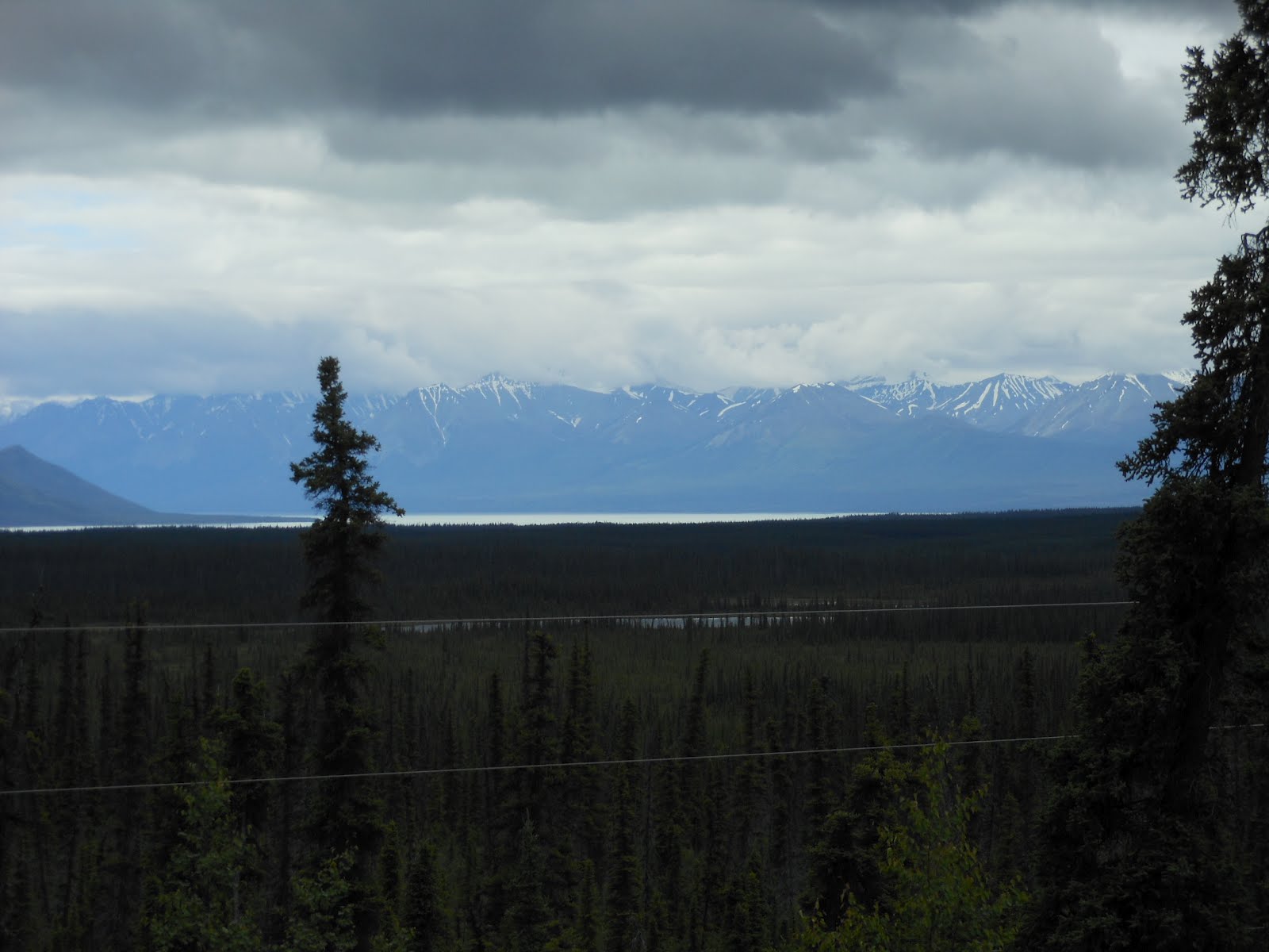
See that glacier off in the distance? It was one of about five we saw today to the south of us. The biggest and most spectacular one I did not get a photo of since I was driving and there was no place to pull over. It was the Nelchina Glacier. I don't know the name of the one in this photo.
Yes, we had grand scenery today, reminding me of the Alps or the Icefields Parkway back in Alberta. When I took this photo, the mountains were still far off, but later they rose near both sides of the highway in dramatic fashion.
Here was a lake completely covered with lily pads:
As you can see from my clothing, it was cold, and on-and-off rainy AGAIN today. The day started off not as scenic as usual, but that sure changed as we got farther along. Early in the day, a big mean pit bull charged out of its yard at me, but then saw Bob right behind and he was easier prey. Luckily Bob got him to back off as the chase went right down the middle of Alaska Hwy 1. Turns out that the lead rider, Rick, also got chased by the same beast.
I took this picture at our first break, 24 miles. Interesting roof decor:
Yes, the scenery got to be spectacular while I was the third driver between miles 46 and 75. Here are some pictures while I was the driver:
I rode the final 23 miles while Rick drove. I happened to be with Bob when he got his first flat tire of the trip, even with those huge tough tires of his. So, now we all have had at least one flat.
Still no wildlife to be seen since we entered Alaska, other than the pit bull and some foxes. We all think it's so strange that our sightings have ended.
Here are a few of my photos during today's final segment.
Can you see the small glacier in the distance? Such fantastic views today.
Our campground has wonderful views too (it's called Grandview). We are very close to the Matanuska Glacier. I did a load of laundry and cooked up the final item in our refrig/freezer that's been there from the beginning - the turkey burgers. Now I just need to go to sleep and tomorrow will be the start of a wonderful week. Jessica Brown and Tomoko Stock are arriving tonight in Anchorage, staying at an airport hotel. Janet arrives about noon, will get the car rental, pick up the others, and then they'll drive north and east until they come to us riding in the opposite direction. Will be fun!
By the way, cell phone reception has been remarkably good ever since we arrived in Tok. It is so nice to be able to talk to Janet, Brian, Katie, and to deal with the outside world. Verizon's coverage map showed only Anchorage and Fairbanks, but we're getting it everywhere.
Monday, July 16, 2012
Sunday, July 15, 2012
Additional photos
Our Internet service is so good here tonight, it's a good time to post more photos.
Headed into dinner at Carriage House next to historic Gakona Lodge (a roadhouse originally built in 1904). Rick and I shared their last red salmon they had.
Waiting for dinner to be served. Lots of antiques and stuffed animals. Their antique cheese grater was identical to the one the Mercurio family had all our lives.
Did they move here from West Virginia?
That's my "artistic" shot along the highway yesterday.
That's a view of the old saloon in Chicken. I took many photos in that unique joint.
After we crossed the Yukon River on the ferry from Dawson City, we had an 8-mile steep climb. This is looking back down on the old gold-rush town.
The Yukon River seen from Top of the World Highway toward the Alaskan border.
"The road ahead" along Top of the World Highway.
Look at those views we had that day! And notice the gravely road Rick is riding on. If only the rutted roads on the Alaskan side had been this nice.
That was a LONG, VERY STEEP hill we had to climb, just prior to the border crossing down the hill behind me.
That Midnight Sun hotel is where we ate dinner in Dawson City. Note again the boardwalks and muddy street. Every car/truck in town was covered with mud. Speaking of, after arriving in Chicken the next night after driving all day on dusty dirt roads with all but Bob's bike hanging off the back, you wouldn't have believed how much dust completely covered every square inch of every part of our bikes. It took LOTS of time to clean them up, especially the working parts like the chains and derailleurs and brakes.
Headed into dinner at Carriage House next to historic Gakona Lodge (a roadhouse originally built in 1904). Rick and I shared their last red salmon they had.
Waiting for dinner to be served. Lots of antiques and stuffed animals. Their antique cheese grater was identical to the one the Mercurio family had all our lives.
Did they move here from West Virginia?
That's my "artistic" shot along the highway yesterday.
That's a view of the old saloon in Chicken. I took many photos in that unique joint.
After we crossed the Yukon River on the ferry from Dawson City, we had an 8-mile steep climb. This is looking back down on the old gold-rush town.
The Yukon River seen from Top of the World Highway toward the Alaskan border.
"The road ahead" along Top of the World Highway.
Look at those views we had that day! And notice the gravely road Rick is riding on. If only the rutted roads on the Alaskan side had been this nice.
That was a LONG, VERY STEEP hill we had to climb, just prior to the border crossing down the hill behind me.
That Midnight Sun hotel is where we ate dinner in Dawson City. Note again the boardwalks and muddy street. Every car/truck in town was covered with mud. Speaking of, after arriving in Chicken the next night after driving all day on dusty dirt roads with all but Bob's bike hanging off the back, you wouldn't have believed how much dust completely covered every square inch of every part of our bikes. It took LOTS of time to clean them up, especially the working parts like the chains and derailleurs and brakes.
On to Anchorage!
Derek, Bob, and Rick (and I, the photographer) churn on toward Anchorage, which as you can see on the mileage sign was 315 miles away yesterday as we left Tok (Bert was driving the RV). We had a pretty easy day of riding. Smooth road, zero hills for the first 40 miles, nice weather. We had beautiful views of snow-covered mountains off to the south and in front of us during much of the ride. What a fabulous bike ride Bob planned for us (if only Janet were here).
Day 30 July 14. Tok to Grizzly Lake Campground. Distance 75 mi. My distance 53 mi.
We had the usual spectacular views, but interestingly, we've seen virtually zero wildlife since entering Alaska. I forgot to mention in the previous blog that three days ago, while Bob and I were riding in the rain toward Dawson City, we saw a porcupine! Anyway, we still enjoyed our lakes and mountain scenes today:
I was the third driver, and got this photo of Rick with Derek and Bob behind. Unbelievable scenery we have everyday, yes?
At one of my stops on the side of the road waiting for the guys to pass by, I took the opportunity to do another thorough cleaning of the RV. I'm always amazed at how much dirt I get off the floors. I took the rugs outside and shook and beat them, swept up the dirt and crud left behind, mopped the linoleum, bleach-cleaned the sinks, and sanitized the counters and toilet. And then vacuumed. Do you think anyone else noticed anything different? hahahaha
We had a very nice campground on a little lake. The other four rented two canoes and paddled around the lake. I had some bike work to do (which Rick later had to bail me out on, because my shift cables have been giving me trouble ever since that day when they both went bad - the day into Whitehorse when I had my only flat tire).
There was no Internet coverage, but there WAS cell phone service!!! Janet and I could talk and text (which makes life immeasurably better), and I could talk to Katie and Brian! Katie and Jeremy are moving on Tuesday to their new home in Eugene, OR!! Here's a photo of the RV in our pretty setting:
After our frozen-lasagna dinner (quite good!), we made Smores. Bob and Derek made the campfire. The day ended with Rick installing a new shift cable on my bike. He's The Man.
Day 31 July 15. Grizzly Lake to Gakona. Distance 49 mi. My distance 71 mi (I rode a little extra).
It was a short ride, with no hills for the initial 30 miles. Overcast and some rain, and "only" 49 miles. Funny how that is so short now. Luckily we have Internet, so it's a profitable afternoon for us. I arrived at our destination at only 12:45 pm, and our lunch was at 11:00 at the 25-mi stop.
Because of the rain, I did not take many photos. I did get this one of the "famous" Copper River, noted for their salmon. The fish swim 300 miles up this river to spawn, and we've seen lots of advertising for salmon fishing guide trips.
We are now getting ready to drive the RV 2.5 miles ahead to this historic roadhouse lodging, originally built in 1904. It is now a restaurant, and look at all the "junk" (oops, I mean antiques) in the front. I took this photo when I rode some extra miles since we finished so early.
Just one more day, then Janet, Bert's wife Tomoko, and Jessica Brown arrive!
Here is a map of where we've been in the past four days, and where we are headed over the next 10 days. In the upper right, the circled "town" is Chicken, where we stayed on our first night in Alaska. Three more circles to the west is where we are now (intersection of Hwy 1 and Hwy 4). Our Anchorage campground is actually in Palmer, 40 miles north of Anchorage. We have a day off on July 18 to tour Anchorage. The next day we go south to Seward for a night. Then we drive back to north of Anchorage, unload the bikes, and begin to ride toward Fairbanks. At that point, we will have eight people for three nights until we reach Fairbanks, when Bert/Tomoko and Janet and I will be in a motel as we will be in Anchorage/Seward. Got that everyone?
Day 30 July 14. Tok to Grizzly Lake Campground. Distance 75 mi. My distance 53 mi.
We had the usual spectacular views, but interestingly, we've seen virtually zero wildlife since entering Alaska. I forgot to mention in the previous blog that three days ago, while Bob and I were riding in the rain toward Dawson City, we saw a porcupine! Anyway, we still enjoyed our lakes and mountain scenes today:
I was the third driver, and got this photo of Rick with Derek and Bob behind. Unbelievable scenery we have everyday, yes?
At one of my stops on the side of the road waiting for the guys to pass by, I took the opportunity to do another thorough cleaning of the RV. I'm always amazed at how much dirt I get off the floors. I took the rugs outside and shook and beat them, swept up the dirt and crud left behind, mopped the linoleum, bleach-cleaned the sinks, and sanitized the counters and toilet. And then vacuumed. Do you think anyone else noticed anything different? hahahaha
We had a very nice campground on a little lake. The other four rented two canoes and paddled around the lake. I had some bike work to do (which Rick later had to bail me out on, because my shift cables have been giving me trouble ever since that day when they both went bad - the day into Whitehorse when I had my only flat tire).
There was no Internet coverage, but there WAS cell phone service!!! Janet and I could talk and text (which makes life immeasurably better), and I could talk to Katie and Brian! Katie and Jeremy are moving on Tuesday to their new home in Eugene, OR!! Here's a photo of the RV in our pretty setting:
After our frozen-lasagna dinner (quite good!), we made Smores. Bob and Derek made the campfire. The day ended with Rick installing a new shift cable on my bike. He's The Man.
Day 31 July 15. Grizzly Lake to Gakona. Distance 49 mi. My distance 71 mi (I rode a little extra).
It was a short ride, with no hills for the initial 30 miles. Overcast and some rain, and "only" 49 miles. Funny how that is so short now. Luckily we have Internet, so it's a profitable afternoon for us. I arrived at our destination at only 12:45 pm, and our lunch was at 11:00 at the 25-mi stop.
Because of the rain, I did not take many photos. I did get this one of the "famous" Copper River, noted for their salmon. The fish swim 300 miles up this river to spawn, and we've seen lots of advertising for salmon fishing guide trips.
We are now getting ready to drive the RV 2.5 miles ahead to this historic roadhouse lodging, originally built in 1904. It is now a restaurant, and look at all the "junk" (oops, I mean antiques) in the front. I took this photo when I rode some extra miles since we finished so early.
Just one more day, then Janet, Bert's wife Tomoko, and Jessica Brown arrive!
Here is a map of where we've been in the past four days, and where we are headed over the next 10 days. In the upper right, the circled "town" is Chicken, where we stayed on our first night in Alaska. Three more circles to the west is where we are now (intersection of Hwy 1 and Hwy 4). Our Anchorage campground is actually in Palmer, 40 miles north of Anchorage. We have a day off on July 18 to tour Anchorage. The next day we go south to Seward for a night. Then we drive back to north of Anchorage, unload the bikes, and begin to ride toward Fairbanks. At that point, we will have eight people for three nights until we reach Fairbanks, when Bert/Tomoko and Janet and I will be in a motel as we will be in Anchorage/Seward. Got that everyone?
Saturday, July 14, 2012
Made it to Alaska!
The border guard took this picture of us just after achieving our goal to bike to Alaska!
Tonight we are in Tok, Alaska. Yesterday we crossed into the United States in a most remote location, on the Top of the World Highway. I have now entered my 49th state, and I plan to get #50 on the way home to Ohio when we drive through North Dakota. This was Bob's 50th and final state!
That's the border crossing over on the right of the photo. The ride to get there from Dawson City ranks up there with one of the most scenic bike rides I've ever taken. We were riding for 64 miles on the ridge of a mountain range, able to look off both directions for seemingly 100 miles on a perfectly clear and sunny day. In one view, an entire mountainside was lavender, because it was covered with wildflowers. Here's just ONE view I captured that day with my camera, but every two seconds we had a changing, most incredible scenery:
Day 26 July 10. Carmacks to Stewart's Crossing, Yukon. Distance 106 mi. My distance 20 mi.
Today's title is MOTORHOME MISHAP. After 46 miles, Bob was turning the RV around on a small side road, and he went beyond the asphalt and the soft shoulder collapsed under the weight of the motorhome. No matter what we did with the shovel, branches, and plastic squares to gain traction, the tires just kept sinking deeper into the soft shoulder dirt.
An electrician, Dave, from Whitehorse (180 miles south), who was applying for a job nearby, stopped to help. We finally decided we were NOT going to get the RV up onto the road, so Dave drove me back to the nearest city, which was where we had spent the previous night in Carmacks (46 miles), to find a tow service. Why not just call for a tow truck? No cell service there. Of course, none of the five of us have cell coverage in Canada, but the electrician did. But for phone coverage we had to head south. Here's a picture of Dave driving his 1990 truck with 200,000 miles on it:
In Carmacks, all three tow services were out of business! Next closest town? Whitehorse, another 120 miles south. Using Dave's cell phone, I called the established towing service, and their cost estimate was $1500!! (Six hours roundtrip, plus the actual winch pull to get us up onto the road.) I got a card for an upstart guy, called him, and he estimated $500. Do it! I waited 2 1/2 hrs for him without any ability to make sure he REALLY was on his way, but he showed up and we drove the hour north to the RV and the guys, who wondered why I had been gone so long. The police were there, with lights flashing. Exciting. Best, the towing guy DID pull us out! Check out this photo with the entire right front of the RV in the air:
By the time it was all over and done, it was 7 pm and we still had to drive 60 miles to our destination campground - which turned out to be OUT OF BUSINESS. What the heck? It had been raining for hours, and we just wanted to go to sleep. We parked in one of the RV sites that "used to be", the only people in the area, then baked two pizzas, took showers, and went to bed. It rained hard the entire night. It felt SO GOOD to be safe and cozy in the watertight motorhome! We slept until 8 am, two hours later than usual!
The day started back in Carmacks with a scrumptious breakfast at the campground restaurant.
I was the day's first driver, and heading out of town I crossed the wide and rushing Yukon River. Little did I know I'd be crossing that bridge four more times that day! When I caught up to the guys, they were stopping at a view spot 18 miles up the road. I wanted to get the same photo of the rapids in the Yukon River, but could not find my camera. I drove back to Carmacks and a good Samaritan at the restaurant had found it and turn it in!!
I later crossed over the bridge with Dave on our way back to Carmacks, and I was in the tow truck on my fifth crossing heading back up to the scene of the mishap.
Day 27 July 11. Stewart's Crossing to Dawson City. Distance 116 mi. My distance 72 mi.
It was still pouring rain in the morning as we drank our coffee (w/o being hooked up to electricity, and with the generator not working, we boiled water and used Nescafe instant). No one was too excited about starting a 116-mi ride in a downpour, so we decided to drive 15 miles to Moose Creek Lodge to see what the forecast was. The guy there said it was supposed to rain for a week. Oh no. We were pretty bummed. We knew that the next day (after Dawson City), the road was dirt, and a muddy road would have been difficult even in the RV. (We were SO glad his prediction was wrong, because the next day we had the most gorgeous weather on a day with spectacular views on the Top of the World Highway.)
Bob and I decided to ride and see how far we wanted to go depending on the conditions. The other three had a second breakfast in the rustic but welcoming cafe:
Because of the rain, I have no photos of the ride to Dawson City. It was getting late, so I finally gave up and got driven in the final 27 miles (Bob had stopped after 40 miles.) The rain stopped for our evening on the town in this historic, colorful gold rush town. It truly did fit exactly the image I had of an old western wild frontier, which in 1900 was the most populated town north of San Francisco. We all went to dinner and downed five huge platters of Chinese food (we shared), along with the rice and two pitchers of Yukon beer.
Then we went to the burlesque show! It's a gambling hall with three shows nightly, run as a not-for-profit by the local tourist association! Funny.
Here's us watching Diamond Tooth Gertie's floor show, after Bob and Derek played blackjack and I lost some coins in the slots. It was a night of fun!
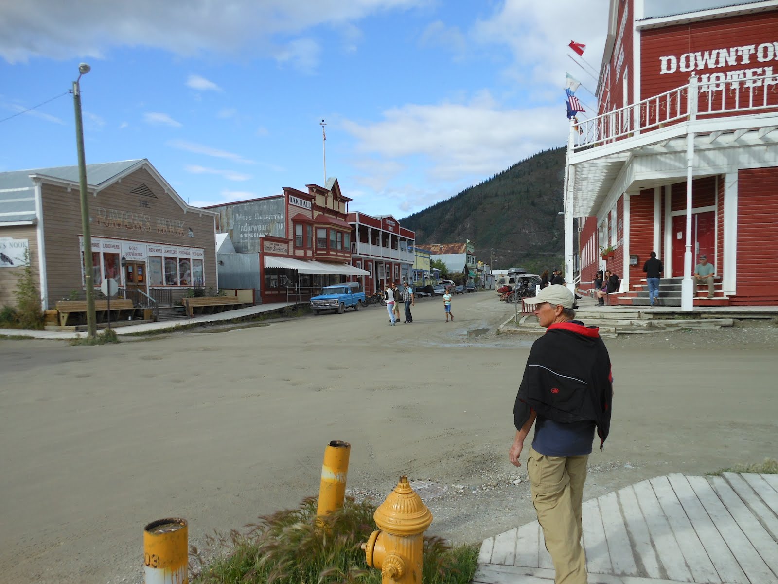
Dawson City was my favorite town so far. Unpaved, muddy streets with huge pot holes. Boardwalks, not sidewalks. Old original buildings and homes. Everything just FIT the image! Here's a photo of Bob, and you can see the potholed muddy street and the boardwalks.
We walked around town some, including along the banks of the Mighty Yukon.
Day 28 July 12. Dawson City, Yukon to Chicken, Alaska. Distance 114 mi. My distance 57 mi.
The day began by crossing the Yukon on a ferry boat. I had to stay in my vehicle, but I got this photo out my window:
This day was one of the most scenic in my life, as I said at the front of this posting. Riding along the ridge of a mountain range at approx 4000 ft elevation, seeing huge panoramic views both north and south, for 100 miles distant, was uplifting and exhilarating.
Eventually, we came to the final steep hill leading to the highest point along the highway, 4525 ft. It was a massive effort to climb that final hill, and then just a mile farther was the border crossing station. Here's a shot of me standing on the Alaska side of the border:
I like this shot of us:
The 64 miles to the border crossing while still in Canada (Top of the World Highway) had a road surface that was pretty bad, but at least most of it was paved; we had to slow way down over the long sections of gravel and dirt. But it was GREAT compared to how bad the gravel road was on the Alaska side, through all of the 46 mi to our destination of Chicken. I could barely ride, having to slow WAY down and negotiate through rocks and loose gravel and ruts and horrible surfaces. I finally gave up, loaded my bike onto the RV, and drove the final 30 miles. Only Bob went on, with his heavy touring bike meant for these kinds of roads. I had to drive the RV so slowly, and Bob was riding so fast, that it took us 26 miles to catch him. Bert and Derek finally decided to ride the final 15 or so miles too.
For me, it was a weird feeling giving up like that and getting sagged in, because it was the first time I'd ever (on a bike tour) given up when others were still riding. I'd stopped before, but only when I felt I should for the sake of others and our schedule. But in this case, Bob was going on, and I elected not to. It sort of ended the "romance" of my being able to hang in there regardless of conditions.
We finally arrived in the tiny settlement of Chicken. It consisted of three small components in this historic gold mining area: two RV parks, and "Downtown Chicken" (each owned by a different person in their population of 20).
Day 29. Today. Chicken to Tok. Distance 78 miles. My distance 58 mi.
Here's a photo showing how those in Chicken have fun with the name of their little stopover.
We had a hilly but nice ride to Tok today. Off in the distance we viewed the snow-capped Alaska Range mountains. Here's about the only photo I took today showing the "road ahead".
Once we got to Tok, we went shopping and got gas. It was so nice to pay $2 less per gallon than it cost in Canada. We stocked up on LOTS of needed groceries. And we all are spending hours in the campground office on our computers getting caught up on blogging, after the four nights without Internet.
We now turn southwest toward Anchorage in four days, when Janet gets to visit. I cannot wait, I've missed her so much, especially when we have no Internet service.
Tonight we are in Tok, Alaska. Yesterday we crossed into the United States in a most remote location, on the Top of the World Highway. I have now entered my 49th state, and I plan to get #50 on the way home to Ohio when we drive through North Dakota. This was Bob's 50th and final state!
That's the border crossing over on the right of the photo. The ride to get there from Dawson City ranks up there with one of the most scenic bike rides I've ever taken. We were riding for 64 miles on the ridge of a mountain range, able to look off both directions for seemingly 100 miles on a perfectly clear and sunny day. In one view, an entire mountainside was lavender, because it was covered with wildflowers. Here's just ONE view I captured that day with my camera, but every two seconds we had a changing, most incredible scenery:
Day 26 July 10. Carmacks to Stewart's Crossing, Yukon. Distance 106 mi. My distance 20 mi.
Today's title is MOTORHOME MISHAP. After 46 miles, Bob was turning the RV around on a small side road, and he went beyond the asphalt and the soft shoulder collapsed under the weight of the motorhome. No matter what we did with the shovel, branches, and plastic squares to gain traction, the tires just kept sinking deeper into the soft shoulder dirt.
An electrician, Dave, from Whitehorse (180 miles south), who was applying for a job nearby, stopped to help. We finally decided we were NOT going to get the RV up onto the road, so Dave drove me back to the nearest city, which was where we had spent the previous night in Carmacks (46 miles), to find a tow service. Why not just call for a tow truck? No cell service there. Of course, none of the five of us have cell coverage in Canada, but the electrician did. But for phone coverage we had to head south. Here's a picture of Dave driving his 1990 truck with 200,000 miles on it:
In Carmacks, all three tow services were out of business! Next closest town? Whitehorse, another 120 miles south. Using Dave's cell phone, I called the established towing service, and their cost estimate was $1500!! (Six hours roundtrip, plus the actual winch pull to get us up onto the road.) I got a card for an upstart guy, called him, and he estimated $500. Do it! I waited 2 1/2 hrs for him without any ability to make sure he REALLY was on his way, but he showed up and we drove the hour north to the RV and the guys, who wondered why I had been gone so long. The police were there, with lights flashing. Exciting. Best, the towing guy DID pull us out! Check out this photo with the entire right front of the RV in the air:
By the time it was all over and done, it was 7 pm and we still had to drive 60 miles to our destination campground - which turned out to be OUT OF BUSINESS. What the heck? It had been raining for hours, and we just wanted to go to sleep. We parked in one of the RV sites that "used to be", the only people in the area, then baked two pizzas, took showers, and went to bed. It rained hard the entire night. It felt SO GOOD to be safe and cozy in the watertight motorhome! We slept until 8 am, two hours later than usual!
The day started back in Carmacks with a scrumptious breakfast at the campground restaurant.
I was the day's first driver, and heading out of town I crossed the wide and rushing Yukon River. Little did I know I'd be crossing that bridge four more times that day! When I caught up to the guys, they were stopping at a view spot 18 miles up the road. I wanted to get the same photo of the rapids in the Yukon River, but could not find my camera. I drove back to Carmacks and a good Samaritan at the restaurant had found it and turn it in!!
I later crossed over the bridge with Dave on our way back to Carmacks, and I was in the tow truck on my fifth crossing heading back up to the scene of the mishap.
Day 27 July 11. Stewart's Crossing to Dawson City. Distance 116 mi. My distance 72 mi.
It was still pouring rain in the morning as we drank our coffee (w/o being hooked up to electricity, and with the generator not working, we boiled water and used Nescafe instant). No one was too excited about starting a 116-mi ride in a downpour, so we decided to drive 15 miles to Moose Creek Lodge to see what the forecast was. The guy there said it was supposed to rain for a week. Oh no. We were pretty bummed. We knew that the next day (after Dawson City), the road was dirt, and a muddy road would have been difficult even in the RV. (We were SO glad his prediction was wrong, because the next day we had the most gorgeous weather on a day with spectacular views on the Top of the World Highway.)
Bob and I decided to ride and see how far we wanted to go depending on the conditions. The other three had a second breakfast in the rustic but welcoming cafe:
Because of the rain, I have no photos of the ride to Dawson City. It was getting late, so I finally gave up and got driven in the final 27 miles (Bob had stopped after 40 miles.) The rain stopped for our evening on the town in this historic, colorful gold rush town. It truly did fit exactly the image I had of an old western wild frontier, which in 1900 was the most populated town north of San Francisco. We all went to dinner and downed five huge platters of Chinese food (we shared), along with the rice and two pitchers of Yukon beer.
Then we went to the burlesque show! It's a gambling hall with three shows nightly, run as a not-for-profit by the local tourist association! Funny.
Here's us watching Diamond Tooth Gertie's floor show, after Bob and Derek played blackjack and I lost some coins in the slots. It was a night of fun!
Dawson City was my favorite town so far. Unpaved, muddy streets with huge pot holes. Boardwalks, not sidewalks. Old original buildings and homes. Everything just FIT the image! Here's a photo of Bob, and you can see the potholed muddy street and the boardwalks.
We walked around town some, including along the banks of the Mighty Yukon.
Day 28 July 12. Dawson City, Yukon to Chicken, Alaska. Distance 114 mi. My distance 57 mi.
The day began by crossing the Yukon on a ferry boat. I had to stay in my vehicle, but I got this photo out my window:
This day was one of the most scenic in my life, as I said at the front of this posting. Riding along the ridge of a mountain range at approx 4000 ft elevation, seeing huge panoramic views both north and south, for 100 miles distant, was uplifting and exhilarating.
Eventually, we came to the final steep hill leading to the highest point along the highway, 4525 ft. It was a massive effort to climb that final hill, and then just a mile farther was the border crossing station. Here's a shot of me standing on the Alaska side of the border:
I like this shot of us:
The 64 miles to the border crossing while still in Canada (Top of the World Highway) had a road surface that was pretty bad, but at least most of it was paved; we had to slow way down over the long sections of gravel and dirt. But it was GREAT compared to how bad the gravel road was on the Alaska side, through all of the 46 mi to our destination of Chicken. I could barely ride, having to slow WAY down and negotiate through rocks and loose gravel and ruts and horrible surfaces. I finally gave up, loaded my bike onto the RV, and drove the final 30 miles. Only Bob went on, with his heavy touring bike meant for these kinds of roads. I had to drive the RV so slowly, and Bob was riding so fast, that it took us 26 miles to catch him. Bert and Derek finally decided to ride the final 15 or so miles too.
For me, it was a weird feeling giving up like that and getting sagged in, because it was the first time I'd ever (on a bike tour) given up when others were still riding. I'd stopped before, but only when I felt I should for the sake of others and our schedule. But in this case, Bob was going on, and I elected not to. It sort of ended the "romance" of my being able to hang in there regardless of conditions.
We finally arrived in the tiny settlement of Chicken. It consisted of three small components in this historic gold mining area: two RV parks, and "Downtown Chicken" (each owned by a different person in their population of 20).
Day 29. Today. Chicken to Tok. Distance 78 miles. My distance 58 mi.
Here's a photo showing how those in Chicken have fun with the name of their little stopover.
We had a hilly but nice ride to Tok today. Off in the distance we viewed the snow-capped Alaska Range mountains. Here's about the only photo I took today showing the "road ahead".
Once we got to Tok, we went shopping and got gas. It was so nice to pay $2 less per gallon than it cost in Canada. We stocked up on LOTS of needed groceries. And we all are spending hours in the campground office on our computers getting caught up on blogging, after the four nights without Internet.
We now turn southwest toward Anchorage in four days, when Janet gets to visit. I cannot wait, I've missed her so much, especially when we have no Internet service.
Monday, July 9, 2012
Tailwinds into Carmacks
Day 25 Whitehorse to Carmacks, Yukon. Distance 116 mi. My distance 92 mi.
We heard that the bears were going to get bigger the farther north we went. Sure enough, this cuddly guy was grazing next to a pond below us, and sauntered off as we stopped to get out our cameras. We also saw bald eagles, but I was driving when they saw the one flying with a fish in its mouth.
This little village of Carmacks is actually a village, and not one of those private roadside stops I have written about recently. Its grocery store is well stocked, and the hotel looks well kept. Here's a photo:
Today's ride was a breeze. Literally! The tailwinds were strong. Cyclists LOVE days like today, especially when the scenery continues to be so gorgeous. Mountains, lakes, rivers, grizzly bears.
Derek rode another 100-mi day, exactly. He stopped as soon as his odometer hit 100. More photos of us today. I'll just have to let the pictures do the talking:
Bert made pancakes for breakfast, and Rick made excellent enchiladas for dinner. For dessert tonight, we shared the first of two HUGE cinnamon buns that Bert bought since he was the one driving when we passed the "world famous cinnamon buns" bakery. It was pretty darned yummy!
Our campsite is right on the fast-flowing Yukon River, and tomorrow morning we will cross over it on that bridge. It flows northwest from here, but then northeast right into Dawson City, where we'll be in two nights. It will be a highlight of our trip, as they have tried to maintain the wild flavor it had during the Klondike gold rush.
The day after Dawson City we enter Alaska! Then just a few days to Anchorage and Janet's visit. I cannot wait.
We heard that the bears were going to get bigger the farther north we went. Sure enough, this cuddly guy was grazing next to a pond below us, and sauntered off as we stopped to get out our cameras. We also saw bald eagles, but I was driving when they saw the one flying with a fish in its mouth.
This little village of Carmacks is actually a village, and not one of those private roadside stops I have written about recently. Its grocery store is well stocked, and the hotel looks well kept. Here's a photo:
Today's ride was a breeze. Literally! The tailwinds were strong. Cyclists LOVE days like today, especially when the scenery continues to be so gorgeous. Mountains, lakes, rivers, grizzly bears.
Derek rode another 100-mi day, exactly. He stopped as soon as his odometer hit 100. More photos of us today. I'll just have to let the pictures do the talking:
Bert made pancakes for breakfast, and Rick made excellent enchiladas for dinner. For dessert tonight, we shared the first of two HUGE cinnamon buns that Bert bought since he was the one driving when we passed the "world famous cinnamon buns" bakery. It was pretty darned yummy!
Our campsite is right on the fast-flowing Yukon River, and tomorrow morning we will cross over it on that bridge. It flows northwest from here, but then northeast right into Dawson City, where we'll be in two nights. It will be a highlight of our trip, as they have tried to maintain the wild flavor it had during the Klondike gold rush.
The day after Dawson City we enter Alaska! Then just a few days to Anchorage and Janet's visit. I cannot wait.
Subscribe to:
Posts (Atom)

